
Destination: Outer Banks of North
Carolina 5/20-23/2013
On the road at 6:00 AM, headed south down US 15, US 17, I-95, US 460 and a few others and we arrived at Deep Creek, Va.
This is the home of Deep Creek Lock marking the northern end of the Dismal Swamp Canal. So now we can see the ground view of the first lock we passed through on our Intracostal Waterway trip aboard our boat TwoGether in 2011. It’s a bit of a trip down memory lane for us. We had a quick look and scrambled back to the van to get out of the rain.
 |
| Waiting for the next opening |
 |
| Deep Creek Lock on the Dismal Swamp Canal |
 |
| NC Welcome Center |
US 17 parallels the canal for the entire 25 mile run and sometimes it’s less than 100 feet from roadside to canal bank.
Then a short trip down US 17 to the NC, Welcome Center where we stayed tied up for the night in November 2011, waiting for Tow Boat US to take us to Elizabeth City for repairs.
Soon we reached the south end of the Canal at South Mills Lock, crossed over the draw bridge and headed for Elizabeth City.
 |
| Sailboats on the Dismal Swamp Canal |

Late afternoon found us at Ocean Waves Campgrounds in Waves, NC. It didn’t take long to set up camp. Ok…we did fiddle around for over a half-hour trying to figure out how to set up the screen room. Hey, it hasn’t been out of the box in 20 years! … Then we walked the 300 yards to the sand dune and climbed over the top and found a pristine beach with crashing waves. It was worth the drive just for this...but there is still so much to see and do.
After a gourmet breakfast of
bacon, egg and cheese sandwiches, cooked on the new Coleman stove, it is time
to set out for the Wright Brothers Memorial and Museum in Kill Devil Hills,
NC. I finally found out where the name
Kill Devil Hills came from. Old kegs of
spoiled rum would wash up on shore from shipwrecks and it was said it tasted so
foul it would kill the Devil himself.
 |
| Wilbur and Orville Wright |
 |
| Wright Brothers Memorial |
Although the town of Kitty Hawk is always associated with the exploits of the Wright brothers, most of their flying experiments took place about 4 miles to the south on the sands of Kill Devil Hills. The town of Kill Devil Hills, where the memorial is located, was incorporated in 1953.
  |
| Orville at the controls. |
The Wright Brothers
selected the Outer Banks for three important reasons. It has mild winters, a nearly constant wind
and soft sand in case of a crash landing.
 |
| Linda uses the Wright Brothers wind tunnel as a desk to write postcards! |
 |
| The Statue of the First Flight |
 |
| Standing in the shadow of my hero Charles Edward Taylor |
I was happy to find a
picture of my hero, Charles Edward (Charlie) Taylor. He is the mechanic who designed and built the engine for
the 1903 Wright Flyer. Little is recorded
of him. However, Orville wrote of him in
his diary. He is an icon among the
aviation maintenance community and the Federal Aviation Administration’s highest
award (for 50 years’ service in the aviation maintenance field) is named the
Charles Taylor Master Mechanic Award. He
died penniless in 1956, eight years to the day after Orville Wright.
 |
| The Wright Flyer Engine |

 |
| Singer Sewing Machine like the one use to sew the fabric on the Wright Flyer |

 |
| This picture is taken at the take off point. Each marker is the landing of the four flights on Dec. 17, 1903. The first flight was 120 ft.; the forth was 852 ft. The farthest flight marker is in the center of the picture at the tree line. |
|
| Wilbur Wright |

 |
| The famous picture of the first powered flight, Dec. 17, 1903 |

 |
| The view of the museum grounds from the base of the monument |

Jockey's Ridge was our next stop. We were told by a neighbor to make sure we stopped at Jockey's Ridge State Park located in Nags Head. Jockey's Ridge is the tallest active sand dune system in the Eastern United States. Shifting winds are constantly reshaping the dunes. Because the Ridge is always changing, it is often referred to as "The Living Dune." It is believed that the name came from the locals (“Bankers” as they are called) racing horses around the dunes years ago.

There is more to it than a gigantic pile of sand. While climbing the dunes will give you quite a work out, there is also hang-gliding complete with a hang-gliding school, kite flying, and walking trails and a good cross section of native flora and fauna.


Fifteen miles south of the
Wright Brothers Memorial is Bodie Island Light (pronounced “Body”). It was built in 1872 and stands 156 feet tall. It is actually the third light to stand in
the local area. While not as popular as the Cape Hatteras Light it is a beautiful
lighthouse in its own right that just went under a restoration and was reopened
in April of this year.
 |
| Bodie Island Light Station |

5/22/2013
 |
| Cape Hatteras Lighthouse |
While definitely the most recognized
light house in America for its beauty, it also has quite a history. Just off Cape Hatteras the warm waters of the
northbound Gulf Stream collide with the cool southbound Virginia Drift an
offshoot of the Labrador Current. This
collision causes storms and rough seas and constantly shifts the Diamond Shoals
which extend about 15 miles offshore.
Water depths can go from over 50 ft. to less than 10ft. in a mile. This is not good for a large vessel that
draws 20 ft. or more. The Hatteras Light
warns ships that they are near the shoals.
 |
| Lighthouse Keepers house |
 |
| Double keepers house (now a museum). |

The original light went into service in 1803. In the late 1860’s it was determined that the deteriorating lighthouse should be replaced. The current structure’s lamp was lit in December 1870. It was approximately 1500 feet inland from the shore. By 1999 the shoreline eroded to the point the lighthouse was only 120 feet from the shore. The Lighthouse was moved intact 2900 feet in 23 days and now again sits 1500 feet from the shore.
 |
| Linda is standing at the original 1803 location. |
After visiting the lighthouse we
stopped at the Frisco Native American Museum.
It was really worth the time to see the collection of artifacts. I have no idea why I left the cameras in the
van but if you click on the link above you can check it out.
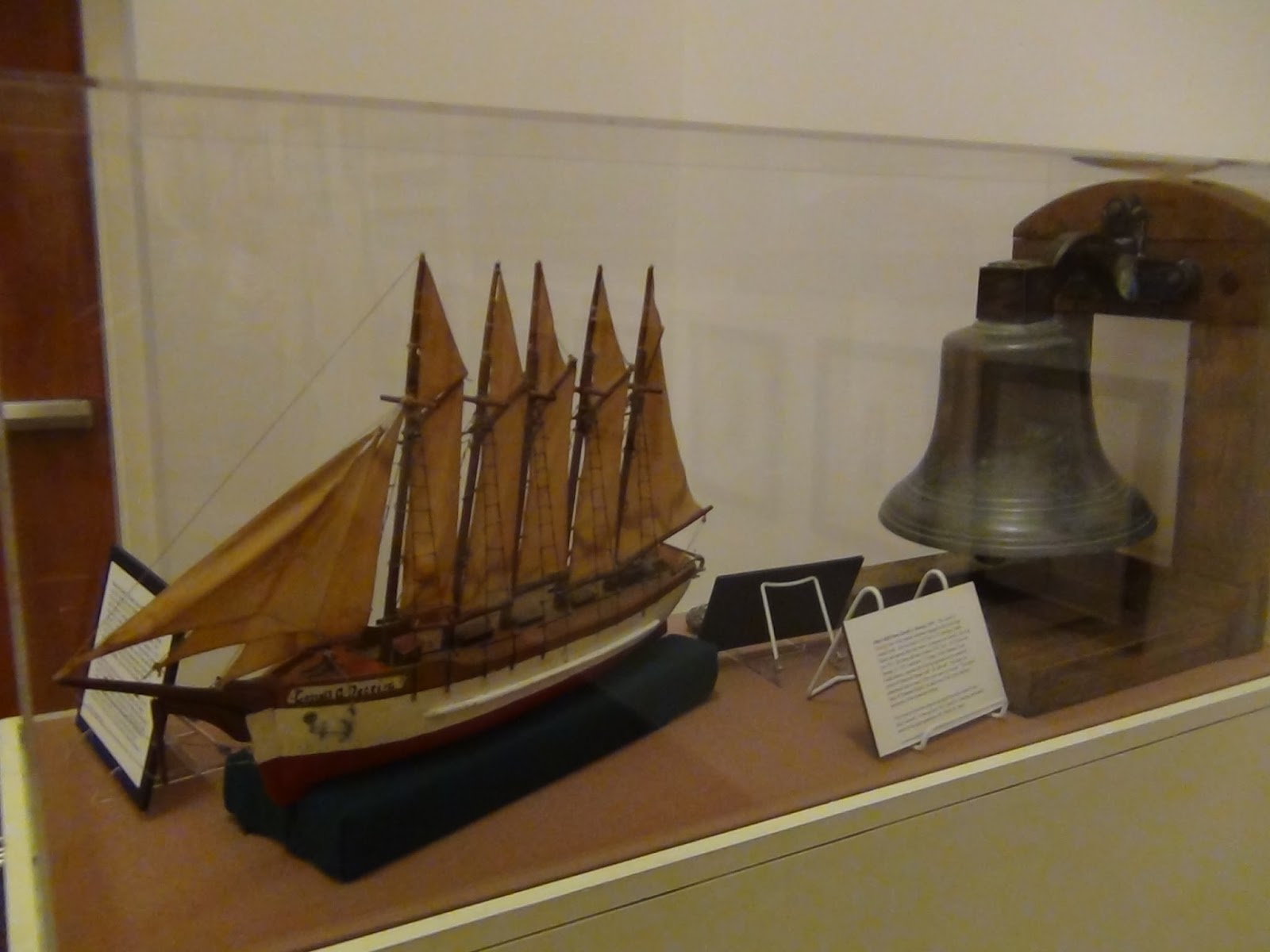
The next stop was the Graveyard of the Atlantic Museum in Hatteras, NC.
 |
| Graveyard of the Atlantic Museum, Hatteras Village, NC. |
 |
| Original Cape Hatteras Lamp and Lens |
The architecture resembles the ribs of an old sailing ship. Here you will find a complete history of the original (1803) Cape Hatteras Light and how the lamp and lens was moved to keep it out of Union troop’s hands. While we really expected to see more history of the shipwrecks, there was rather little on the subject except for the loss of the “Alligator” a civil war submarine. There is a display of the history of SCUBA diving equipment and its evolution that was interesting. There was also a display of the commercial fishing that takes place in the Outer Banks. I wouldn’t drive the whole way to just see this museum but when you’re in the area its worth a visit. There is no admission!
Back at the campgrounds we took a walk to the beach and watched the fishermen and enjoyed the sights, sounds, and smells of the ocean.
 |
| Snack Time |
 |
| Trying for the catch of the day. |
 |
| Can you see me? I can see you! |
 |
| This is my fifth shark today! |
5/23/13.
The drive home had the
windshield wipers busy. We had two days
of perfect weather to explore OBX and check out the camping experience. This is a must do again!
Thanks for coming along!